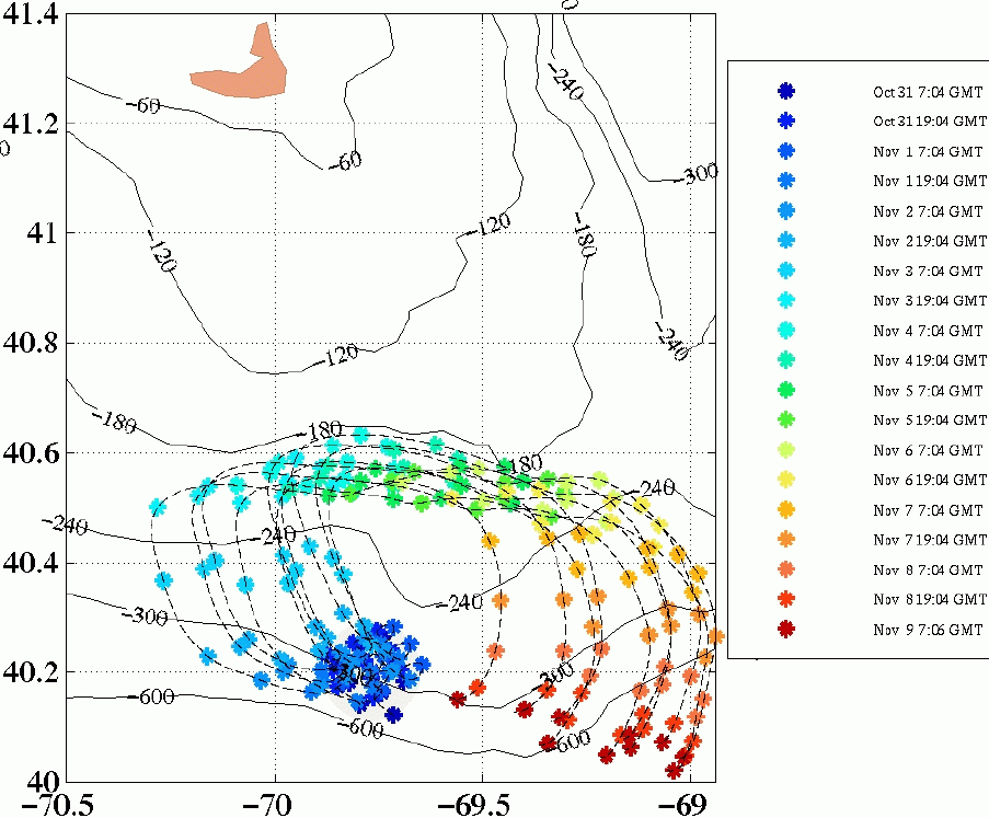
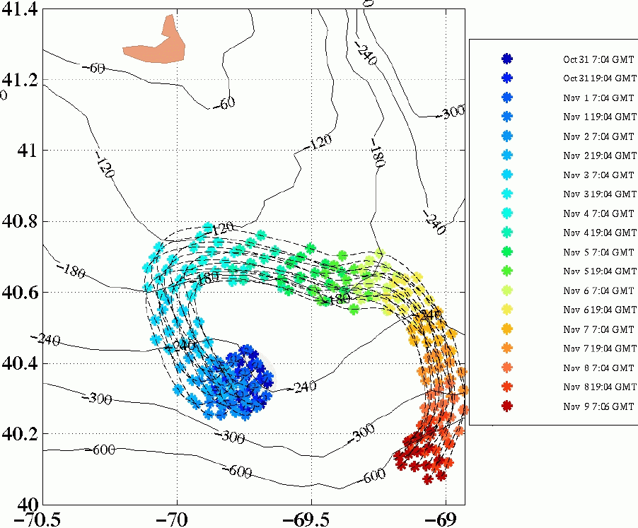
Potential Debris Paths
The figures below depicts the potential drift paths of floating debris for the period
31 October - 9 November. The gray circle indicates an area 10km in radius
from the presumed impact point of Egypt Air Flight 990. Particles located within
the gray circle at the time of impact (0700 GMT 31 October) are tracked for the
duration of the simulation period. The paths of these particles are plotted
for every model time step. 12 hour intervals are indicated by the asterisks.
Bottom contours are labeled in feet.
The left figure corresponds to an impact point located at 40.20N, 69.75W, while the
figure to the right corresponds to an impact point located at 40.35N, 69.75W.
The impact points have been estimated based on differing reports from the news media.
|
|
|
|
|
|
Potential paths of floating debris: 31 October - 9 November.
(Click on each image for larger size version)
Overall, the trajectories of the floating debris are dependent upon
the winds (strength, direction and pattern) and
the internal ocean dynamics (meandering shelfbreak front,
westward sluggish shelf currents and eddies, and Gulf Stream warm-core rings).
As shown above, the initial trajectories of the potential debris are influenced
by the location of the area of possible impact site with respect to an
oceanic front, the shelfbreak front.
The surface currents of the front are westward-southwestward,
meandering approximately along the path of the 300 foot isobath.
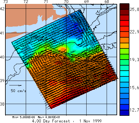
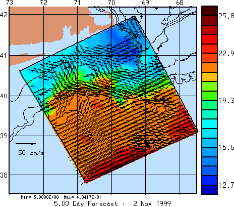
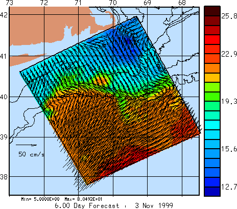
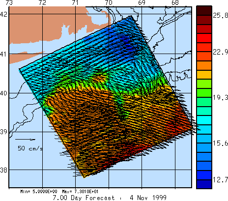
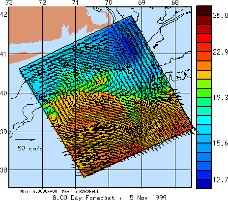
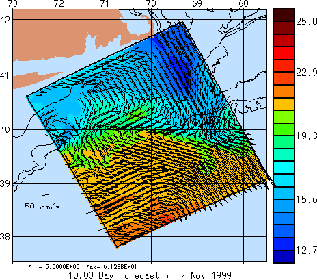
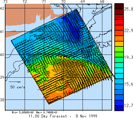
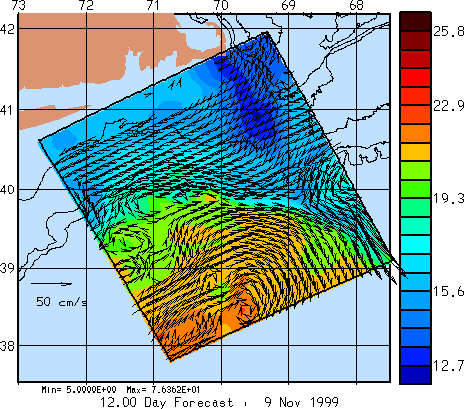
Temperature and Velocity Fields
The images below illustrate the 4-dimensional (space and time) simulation which
was utilized
to produce the potential floating debris paths shown above. Daily plots over
the duration of the forecast period are included. Each image shows
the temperature values at the 5 meter depth, overlaid with velocity vectors
at the same depth. The temperature scale is in Celsius and the velocity
scale arrow shown is 50 cm/s. Vectors are not
plotted if the velocity is below 5 cm/s. Note that the forecast period
begins on 2 November.